

| FAA Identifier: | P08 |
| Lat/Long: | 32.56.16N / 11.25.59W |
| Elevation: | 1574 ft. / 479.8 m (surveyed) |
| Variation: | 12E (1985) |
| From city: | 5 miles SE of Coolidge, AZ |
| Zip code: | 85228 |
Airport Operations
| Airport use: | Open to the public |
| Sectional chart: | Phoenix |
| Control tower: | no |
| ARTCC: | Albuquerque Center on 125.4 |
| FSS: | Prescott Flight Service [1-866- 226-3763] |
| NOTAMs facility: | PRC (NOTAM-D service available) |
| Attendance: | Mon-Fri 0800-1700, Sat-Sun 0800-1600 |
| Pattern altitude: | 2574 ft. MSL |
| Wind indicator: | yes |
| Segmented circle: | yes |
| Lights: | Dusk-Dawn ACTVT MIRL RY 05/23 – CTAF. |
| Beacon: | white-green (lighted land airport) |
Airport Communications
| CTAF/UNICOM: | 123.075 |
- APCH/DEP SERVICE PROVIDED BY ALBUQUERQUE ARTCC ON FREQS 125.4/269.3 (GLOBE NR 2 RCAG).
Nearby radio navigation aids
| VOR radial/distance | VOR name | Freq | Var | |||
|---|---|---|---|---|---|---|
| TFD r071/24.5 | STANFIELD VORTAC | 114.80 | 12E | |||
| IWA r140/24.8 | WILLIE VORTAC | 113.30 | 13E |
| NDB name | Hdg/Dist | Freq | Var | ID | ||||
|---|---|---|---|---|---|---|---|---|
| CHANDLER | 124/27.6 | 407 | 12E | CHD | ||||
| MARANA | 329/33.2 | 245 | 12E | AVQ | ||||
| FALCON FIELD | 142/35.1 | 281 | 12E | FFZ |
Airport Services
| Fuel available: | 100LL & Jet-A (self-serve) See Pricing on Home Page |
| Parking: | Tiedowns |
| Airframe service: | MINOR |
| Powerplant service: | MINOR |
| Bottled oxygen: | NONE |
| Bulk oxygen: | NONE |
Runway Information
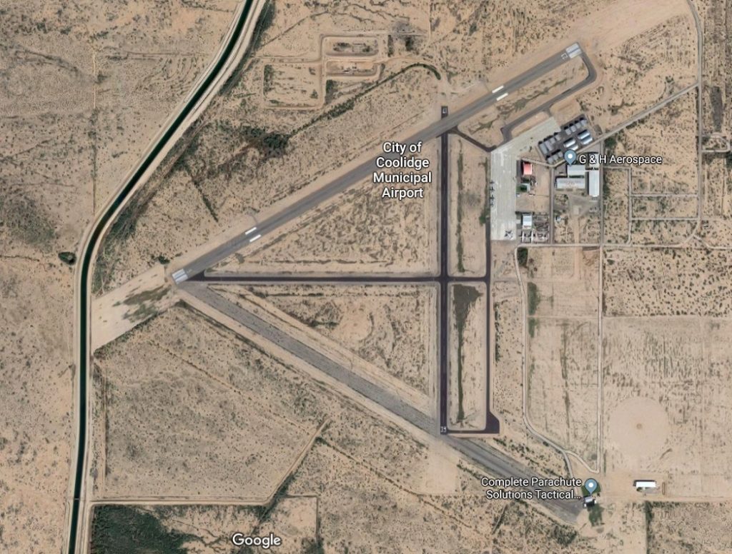
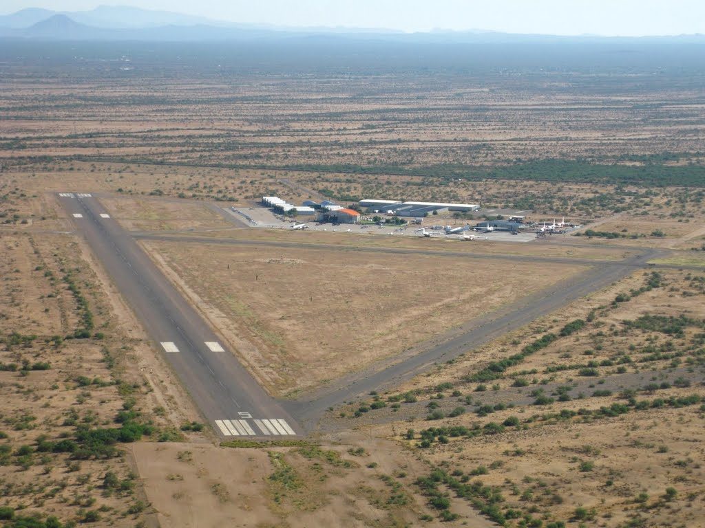
Runway 5/23
| Dimensions: | 5528 x 150 ft. / 1685 x 46 m | ||||||||
| Surface: | asphalt, in good condition (To Be Resurfaced 11-2019 thru 3-2020) | ||||||||
| Weight limitations: |
|
||||||||
| Runway edge lights: | medium intensity | ||||||||
| RUNWAY 5 | RUNWAY 23 | ||||||||
| Latitude: | 32-56.018667N | 32-56.473667N | |||||||
| Longitude: | 111-26.120500W | 111-25.183833W | |||||||
| Elevation: | 1548.0 ft. | 1574.0 ft. | |||||||
| Traffic pattern: | left | right | |||||||
| Runway heading: | 048 magnetic, 060 true | 228 magnetic, 240 true | |||||||
| Displaced threshold: | 50 ft. | 35 ft. | |||||||
| Markings: | nonprecision, in good condition | nonprecision, in good condition | |||||||
| Visual slope indicator: | 2-box VASI on left (3.00 degrees glide path) & RWY 23 VASI OTS INDEFLY. |
2-box VASI on left (3.00 degrees glide path) | |||||||
| Runway end identifier lights: | no | no | |||||||
Runway 17/35
| Dimensions: | 3861 x 75 ft. / 1177 x 23 m | ||||
| Surface: | asphalt, in good condition | ||||
| Weight limitations: |
|
||||
| Runway edge markings: | /35 CNTRLN FADED. | ||||
| RUNWAY 17 | RUNWAY 35 | ||||
| Latitude: | 32-56.358667N | 32-55.722000N | |||
| Longitude: | 111-25.502167W | 111-25.502167W | |||
| Elevation: | 1565.0 ft. | 1573.0 ft. | |||
| Traffic pattern: | right | left | |||
| Runway heading: | 168 magnetic, 180 true | 348 magnetic, 000 true | |||
| Markings: | basic, in good condition | basic, in good condition | |||
| Runway end identifier lights: | no | no | |||
Additional Remarks
| – | RWY 05/23 HAS DISTANCE MARKERS. |
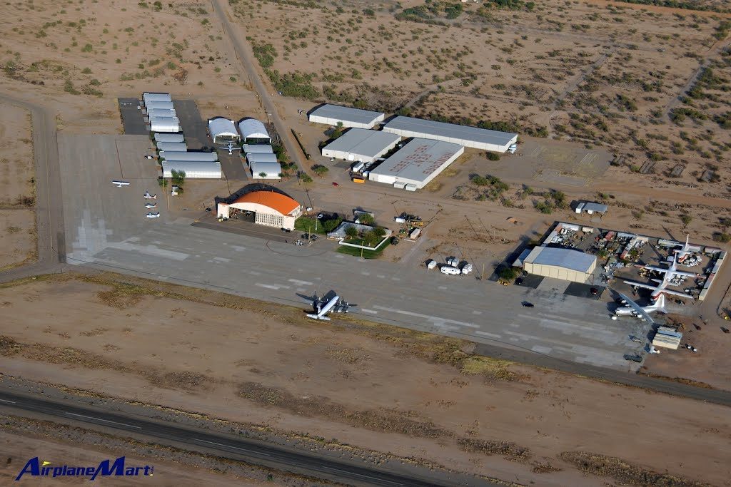
| – | LARGE MILITARY TRANSPORTS IN VICINITY OF AIRPORT. |
| – | PARACHUTE JUMP TRAINING ON AIRPORT. DROP ZONE LOCATED SE OF RWY 35. |

